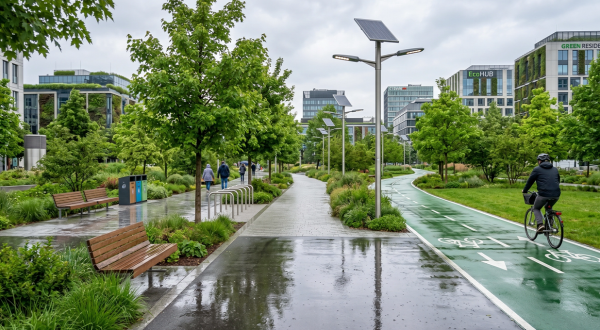
Improved traffic flow, safer and more comfortable roads for the travelling public, reduced CO2 emissions… these are some of the things that smart roads promise to deliver. Such benefits are closely tied up with advances in connected car technology. It’s a subject that is the focus of active research in Greater Paris.
On 9 March 2017, the Greater Paris regional council approved a major plan to reduce congestion. Some €250 million will be dedicated to the plan over a 5-year period, of which €58.2 million will be earmarked for smart roads. In keeping with the national “Mobilité 3.0” programme introduced by the French government as a follow-up to COP21, the scheme aims to relieve congestion and improve traffic flow across the whole Greater Paris road network with a view to reducing greenhouse gas emissions and enhancing passenger safety.
“@Way provides unprecedented scope when it comes to general road network monitoring, geolocation and vehicle tracking”
To do this, the region intends to initiate a collaborative testing process and to mobilise an ecosystem of players ranging from manufacturers, developers of innovative connected solutions, and safety and environment specialists through to operators. This is because the programme is set to encompass issues relating to road infrastructure, operation, vehicles and use patterns.
Connected cars will serve as technological stimulus
Over the past two or three years, studies into smart roads have been driving a number of joint initiatives like Scoop@F, a major testing programme for connected cars that involves car manufacturers such as PSA and Renault, highway authorities, universities and research centres.
“Connected cars will undoubtedly provide the technological stimulus to take road infrastructure management into a totally new era, one in which information is supplied not just from the proprietary infrastructure of operators and local authorities but also from vehicles and built-in mobile terminals,” says Gilles Ragey, Business Unit Manager at Mobility ITS. This VINCI Energies entity is currently testing a next-generation platform called @Way, in cooperation with most European connected car schemes.
In the age of mobile applications, open data, the Internet of Things and connected cars, it’s crucial that infrastructure management be taken to a whole new technological level. So how does it work? @Way is a scalable platform that supports a set of business modules, capable of adapting to the infrastructure, road network and proprietary organisational procedures of any operator.
“By taking into account the full range of new mobile devices (laptops, tablets, smartphones), @Way provides unprecedented scope when it comes to general road network monitoring, geolocation and vehicle tracking, or to the installation of specific business applications,” points out Gilles.
Anticipating emergency measures
It’s easy to imagine the benefits of this kind of open model. If, for example, windscreen wipers switch on simultaneously on the same stretch of road, or if several vehicles slow down or brake suddenly on entering a town, then this information – which is transferred the second it is generated then interpreted just as quickly – is used to trigger an emergency action plan.
Information also flows in the other direction since @Way enables operators to send data that facilitates driving and passenger experiences towards traffic information panels and right to connected cars via specific applications. “The platform incorporates all the diversions and secondary roads with much greater accuracy than domestic GPS systems,” says Gilles.
The systems resulting from these pilot smart road programmes could become operational as of 2018.
11/09/2017