La Défense adopts hypervisor platform to streamline city management
Reading time: 3 min
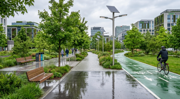
© Pexels
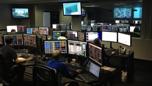
The hypervisor developed by Actemium Paris Transport enables the operator of La Défense business district to view and correlate in real time all of the data transmitted on the site, ensuring efficient incident management.
A smart city relies on the collection and real-time processing of an exponentially growing amount of data. A city within a city, La Défense business district in Paris has equipped itself with a hypervisor, a platform that brings together the site’s various monitoring systems so as to streamline operation.
Installed in the site’s security control centre on behalf of the two bodies responsible for developing and managing the district (EPADESA and DEFACTO), the hypervisor produced by VINCI Energies provides a 3D view of all the data generated, against the backdrop of multiple physical layers (RER train, motorway, underground, pedestrian esplanade, internal roads, service ducts, etc.). It thereby facilitates optimum and timely decision-making, particularly in terms of maintenance and safety.
Efficient mapping
“This efficient mapping system features around 10 technical interfaces that make it possible to unify orders, say for intercoms, lighting, information panels or emergency phones,” explains Clémence Borezée, project manager for Actemium Paris Transport (VINCI Energies). “The point is to be able to geolocate all potential incidents and to transfer this information so as to manage several of the areas concerned at the same time.”
The hypervisor system offers a cross-cutting view of issues and breaks with a silo-based way of thinking and operating.
More than 15,000 facilities can be monitored or used for tracking purposes. “For example, if someone takes ill near the Miró sculpture, then this information enables the management system to make the most appropriate decisions, improving efficiency and speed,” adds Clémence. The hypervisor can manage all types of sensors and actuators thanks to a 3D overview, and it can adapt all resources to optimise incident resolution. “That ranges from opening and closing doors for the fire services to managing traffic lights to relieve congestion,” she says. It means that for minor incidents such as camera failure, maintenance operations are easier and quicker.
Energy and time savings
This efficient mapping technology is also used for the Tancarville and Normandy bridges. “The site is very different but the hypervisor can be configured to suit individual needs. Only the communication protocols need to be altered so that they can be customised,” stresses Clémence.
The hypervisor system offers a cross-cutting view of issues and breaks with a silo-based way of thinking and operating, thus delivering valuable energy and time savings, especially in emergency situations.
In time, resources may also be made available to residents as open data, to help them find a parking space more easily, for example. Businesses have much to gain from embracing this tool, in terms of better meeting their customers’ needs and making their mobility experiences smoother.
13/12/2017