The drone used by Omexom in the Gulf states not only cuts down on resources and inspection time, but it provides electricity transmission experts with a “third eye”.
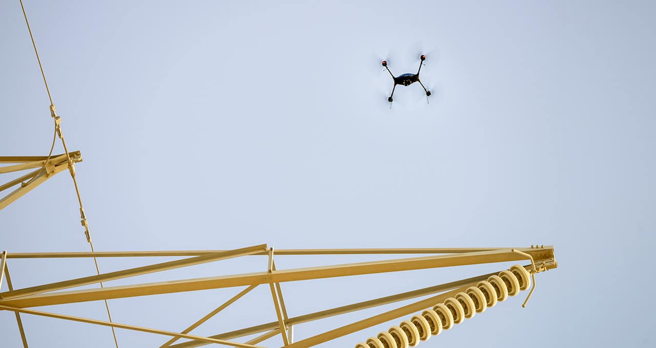
Inspecting HV power lines in the deserts of Saudi Arabia can sometimes be risky. Furthermore, it is extremely time-consuming when carried out using traditional methods by operators who have to climb to the tops of transmission towers. The use of a drone, a solution recommended and implemented by Omexom in the Persian Gulf for some 900 km of power lines, has radically changed the equation. Particularly in terms of costs.
“Drones can monitor equipment that is difficult for human operators to see during an inspection.”
“Drones save time and cut down the number of workers involved. Two people inspect the transmission tower, and the operation takes between 15 and 30 minutes,” says Guillaume Jahan, manager of Omexom Saudi Maintenance (VINCI Energies). “Without drones, the same inspection requires three people over a 4-hour period.” The quality of the inspection is also better because “drones can examine equipment that is difficult for human operators to see during an inspection, such as an insulator located on the outer side of the line.”
Moreover, technical inspections conducted by drones do not involve any asset downtime – the power line remains live. Without the risk of electrocution, drones can get closer than humans to areas of electrical current so as to detect invisible-to-the-eye discharge using an ultraviolet Corona camera. Thanks to LiDAR (light detecting and ranging) technology, drones can produce 3-dimensional models of power lines and detect, among other things, sand movement on the ground that can create a dune beneath the power line, involving a risk of electrical arcing (risk of electric shock without contact).
The technology is set to be further improved through the installation of a dual-control syste, where the pilot flies the drone and a separate operator focuses fully on images, as well as through the implementation of a system to pre-programme flights (autopilot from the base towards the top of the tower) and to compare images so that potential faults can be anticipated. The project will represent a new technological leap.
15/10/2018