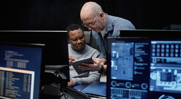
Data can be very powerful in helping to develop and implement public policies in a variety of areas, such as risk prevention, water management and sea freight. Companies in the private sector are at the forefront in this matter, including Axians in the Netherlands.
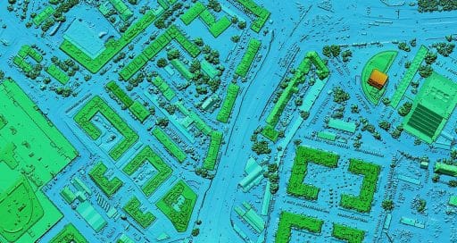
The Netherlands and Switzerland are among the most advanced countries in terms of Lidar mapping.
Data can be used to benefit the population as information can be combined from a great many sensors collecting a considerable amount of data in real time. Such smart data can power new services able to facilitate and improve people’s lives, in particular by helping to implement public policies.
One such example in France is the initiative developed by the French National Institute of Geographic and Forest Information (IGN), which involved developing a high-definition Lidar* map of the country. By generating accurate and detailed geographic data, the project, the initial modules from which will be available in late 2022/early 2023, will support public authorities to put in place their policies related to agriculture, forestry, the environment, urban development and energy.
Powering new services to improve people’s lives by helping to implement public policies
The tool will enable the French National Forest Office (ONF) and private management companies to better understand what state the forests are in and how they are changing as a result of climate change. These models could also serve to simulate natural disasters and predict the risk of flooding and rock slides. The Netherlands is one of the countries driving Lidar mapping, having already conducted four such exercises, and Switzerland is mapping its territory for the second time.
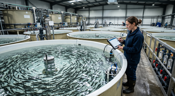
Managing a watershed
The private sector clearly has a part to play in driving this approach of using data to optimise public policies. Waterschap Hollandse Delta (WSHD), the authority that manages 758 kilometres of dykes and dunes between Rotterdam and Dordrecht, 1,600 kilometres of road and cycle path, and 20 wastewater treatment plants, contracted Axians Netherlands to help design the architecture for a New Water System Control data platform, which ultimately will enable WSHD to improve the way it manages the water system in the region. It will serve to calculate the impact of the various meteorological scenarios and therefore control the locks to ensure the water stays at an optimal level.
“These checks will initially be suggested by the system, but in time it will become automated,” explained Alexander van Helm, Technical Director at Axians in Laren. “We were able to add value to this project by developing a comprehensive and detailed conceptual architecture based on a standard approach and methodology that takes account of the complexity of data in managing water.”
Digitising the largest port in Europe
Axians boasts considerable expertise in digitisation. The expert ICT brand has been working for several years on another large-scale project to digitise processes at the port of Rotterdam, the largest port in Europe.
“In partnership with IBM and Cisco, we built an IoT platform that measures several parameters (including currents, tides, pressure, temperature, turbidity, wind and visibility) so as to optimise the movement of vessels in the port,” said Alexander van Helm.
Using the Internet of Things, the port authority can collect myriad data that it then processes and makes available to those concerned through different filters. The data platform of the port of Rotterdam makes it possible to monitor the movement of vessels, the state of the infrastructure, as well as meteorological, geographic and hydrological data.
The use of data and digitisation means the container terminal at the industrial park of Maasvlakte is already operated without human intervention, with autonomous cranes and remote-controlled trucks. The idea is that vessels will be able to enter and exit the port completely autonomously by 2030.
Undeniably, data represents a major opportunity for local authorities and public institutions in general. The potential scope of application is enormous. Nevertheless, using data to steer public policies means a specific method must be followed to ensure the quality of data and the decisions that are made, without overlooking the ethical considerations of such an approach.
* LiDAR: A method of remote detection that creates a three-dimensional array of points from which various digital models can be generated, for example a model of the topography (land, above ground and ground elevation)
14/12/2022