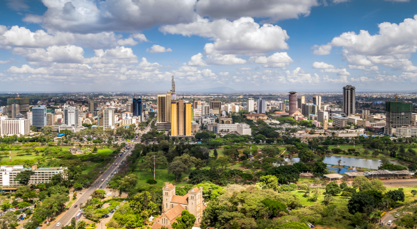
To relieve traffic congestion, urban areas are now using cameras and loop counters. In future, “Floating Car Data” (FCD), will enable them to regulate traffic by collecting large volumes of localisation data from moving vehicles. One such system has been set up in Rouen, France, where the local authorities are working with Citeos.
Traffic jams are known to harm the environment but there is less awareness of their economic impact. Traffic jams on roads and motorways cause a major budget outlay for governments. According to INRIX, a supplier of solutions for the transport sector, traffic jams will cost the Western economies €221 billion per year by 2030.
In France, the annual cost will be €22 billion, up 31% from 2013. Of all the cities included in the scope of the INRIX study, Paris will experience the sharpest increase (51%).
Combatting traffic jams is an absolute priority for cities. “Not only is it technically impossible to widen the streets in large cities, but city authorities are now called on to limit the number of cars in order to reduce pollutant emission levels and congestion costs,” says Citeos in Rouen (VINCI Energies) Business Unit Manager Jean-Marc Raymond.
The most efficient way to do this is to regulate traffic, especially now that cities have an excellent tool for this purpose: FCD.
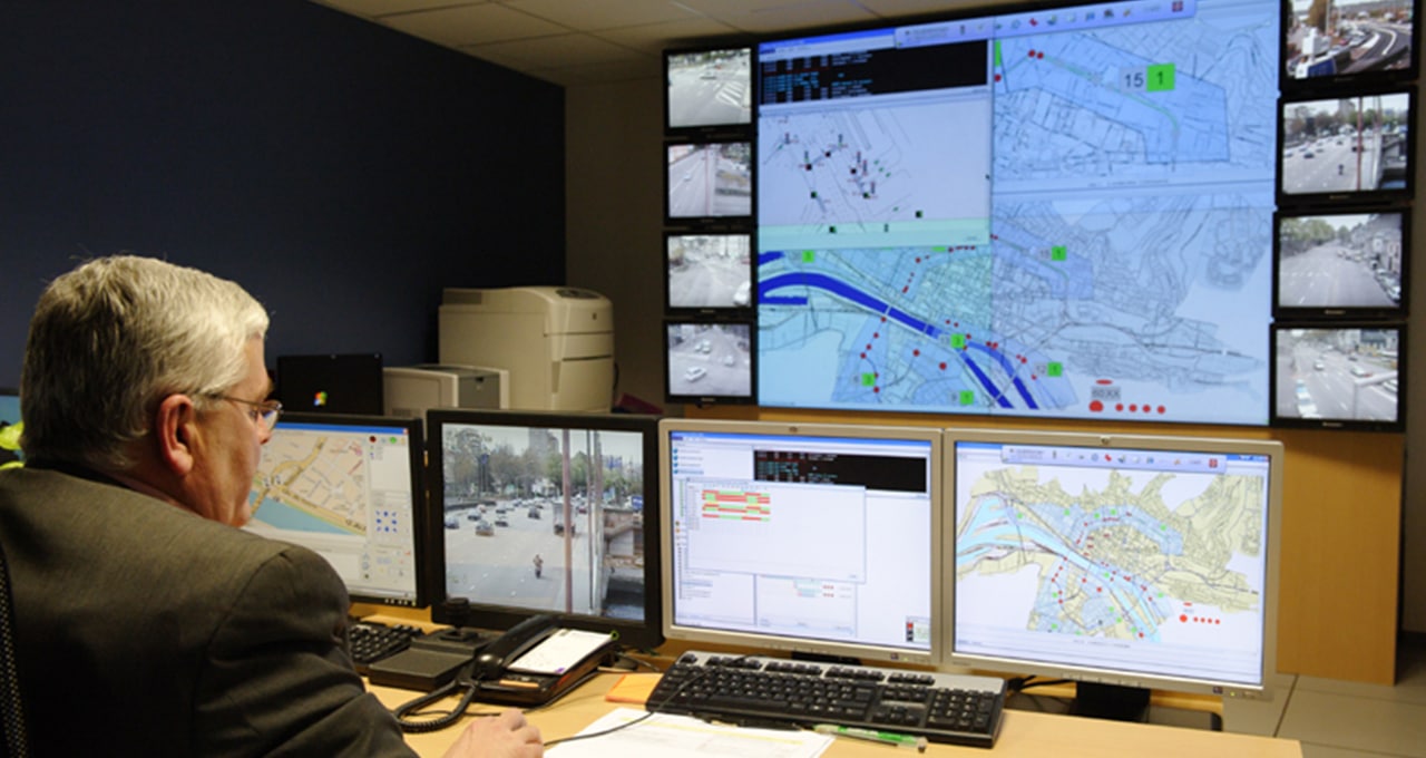
Today, most urban areas are investing in algorithm-based traffic control systems. For example, the Traffic Control Centre (PCRT) in the north-western French city of Rouen can change intersection traffic light loops, utilise information provided by CCTV cameras and sensors installed along streets, disseminate messages to drivers via message boards located near the main arteries, share information on the website, and send motorists text message alerts.
Multimodal control
“Current developments in supervision systems make it possible to think not only in terms of the automobile itself, but to include data measurement and processing in a multimodal control approach that includes pedestrians, taxis, public transport, bicycles, and smart vehicles,” says Jean-Marc Raymond.
“Floating Car Data is a flexible and responsive solution”
In future, traffic monitoring, still primarily based on data from loop counters embedded in the carriageway, will increasingly use Floating Car Data (FCD).
FCD uses the telecommunication network to anonymously report vehicle geolocation data via GPS navigation systems, radar detectors, and smartphone applications. This raw data is processed to provide information on traffic speed per section as well as traffic flow and congestion.
“FCD offers several advantages. It is a flexible and responsive solution. It does not require equipment installation (CCTV cameras, traffic loops) or in situ maintenance. In addition, it uses independent equipment, which protects measurement from service interruption,” says Jean-Marc Raymond.
15/10/2018